Research
Bonsai World and the Reality of Outdoor Simulation
Discover how Bonsai Robotics uses satellite imagery and world models to prepare autonomous machines for unpredictable outdoor environments.
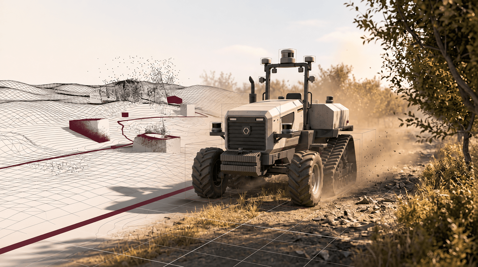
Deploying autonomous machines in unstructured outdoor environments presents a fundamental scaling challenge for robotics. While indoor warehouse automated guided vehicles operate under controlled illumination, predictable floor traction, and rigid spatial grids, outdoor autonomy platforms must navigate loose soils, dense dust clouds, and canopy cover where GPS signals degrade. Field testing under these circumstances is slow, seasonal, and expensive. Bonsai Robotics developed Bonsai World, an environment-conditioned world model built to recreate and augment real operational terrain in simulation before machines deploy on physical soil.
Satellite Reconstruction and Structured World Modeling
Instead of engineering generic, procedural digital twins from scratch, Bonsai World anchors its simulation pipeline to real-world geography. The system ingests satellite imagery of target farms, orchards, or mining sites and interprets spatial structures using Google's Gemini vision-language foundation models.
This reconstruction pipeline converts overhead optical data into a structured 3D spatial map, capturing tree-row spacing, field boundaries, elevation changes, and terrain contours. Bonsai post-trains this world model using operational telemetry and perception feeds drawn from over 50 million real-world samples across more than one million operating acres. By marrying macro satellite data with ground-level vehicle data, the model generates high-fidelity bird's-eye-view representations and synthetic camera views that match the target deployment site.
Edge-Case Synthesis for Rugged Perception
Reconstructing nominal field geometry is only the first hurdle. Autonomous ground machinery fails most frequently at unpredictable physical edge cases: airborne dust generated by flail mowers, lens occlusion from plant matter, dynamic agricultural workers, changing shadows through orchard canopies, and rutted soil.
Bonsai World injects targeted synthetic variations directly into the reconstructed 3D environments:
- Visual Attenuation: Simulating dense dust, low sun glare, and lens fouling to evaluate whether vision-based state estimators maintain tracking.
- Topographical Perturbations: Introducing mud, ruts, and varying rolling resistance to stress-test low-level traction and steering controllers.
- Dynamic Obstacles: Injecting unexpected animal crossings, fallen irrigation lines, and nearby utility vehicles into the vehicle’s planned path.
Exposing the autonomy stack to thousands of randomized variations in simulation reduces the need to wait for rare field conditions to happen naturally during physical runs.
The Operational Edge of Site-Specific Simulation
In robotics, general-purpose world models frequently prioritize visual aesthetics over physical and operational utility. Simulating every corner of the planet is unnecessary for an autonomous tractor or commercial mower. What matters is reproducing the exact fields where the machine must work, along with the sensory failures that cause real shutdowns.
By grounding its world model in site-specific aerial maps and fleet sensor history, Bonsai Robotics treats simulation as an operational pre-flight test. Rather than sending engineering teams on site for weeks of manual parameter tuning, machines can validate navigation policies, verify failsafes, and rehearse edge cases in software, bringing outdoor autonomy closer to turnkey deployment.
FAQ
What is Bonsai World?
Bonsai World is a simulation and world-modeling platform developed by Bonsai Robotics that converts satellite imagery and fleet data into structured 3D environments to validate outdoor autonomous equipment before physical deployment.
How does Bonsai World generate 3D farm environments from satellite images?
The system passes overhead satellite imagery through vision-language foundation models (including Google Gemini) to identify field geometry, row layouts, and terrain elevation. It then uses post-trained world models conditioned on real fleet telemetry to reconstruct realistic, ground-level 3D scenes.
Why is physical simulation critical for outdoor agricultural robots?
Outdoor agricultural environments experience harsh variables like heavy dust, GPS occlusion under tree canopies, rough terrain, and seasonal weather shifts. Simulating these conditions allows engineers to test edge cases repeatedly and safely without risking hardware damage or waiting for specific field conditions.
Does Bonsai World eliminate all real-world field testing?
No simulation platform completely eliminates the physical sim-to-real gap. Bonsai World minimizes the initial commissioning overhead and catches high-risk failure modes in software, but physical machines still require baseline mechanical calibration and real-world safety validation.